
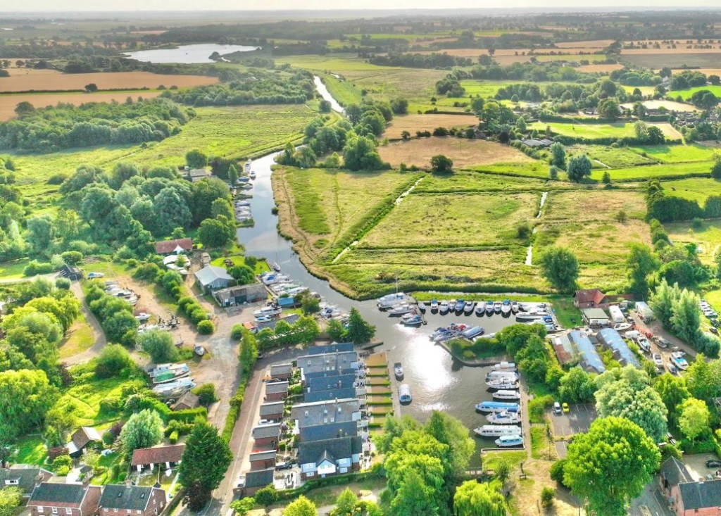
Recently, I stumbled across a fuzzy aerial view of Loddon Staithe, the inland harbour which divides our sleepy parish of Chedgrave from our larger next-door neighbour. Traditionally, a staithe was a wharf for loading and unloading cargo from wherries – flat-bottom sailing ships – which plied their trade up and down the waterways. Back in the day, it was the best (and often the only) way to get coal to the fire and wheat to the mill. Business was brisk until it was killed off by the unstoppable march of the internal combustion engine. Nowadays, the Staithe is the domain of would-be sailors mucking about in pleasure boats and some fancy houses overlooking the glassy waters with their own private moorings.
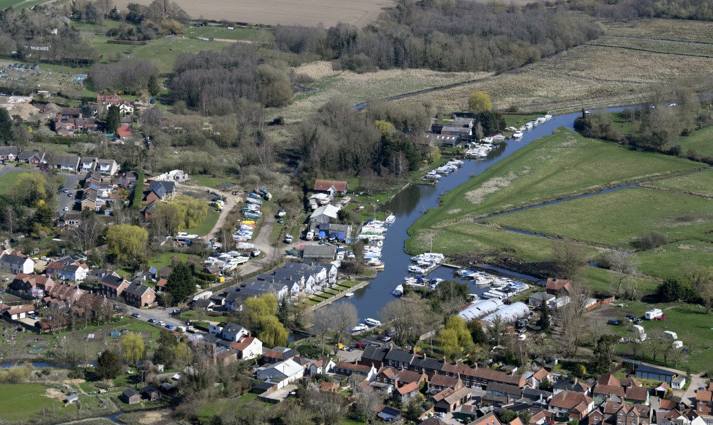
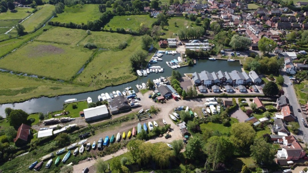
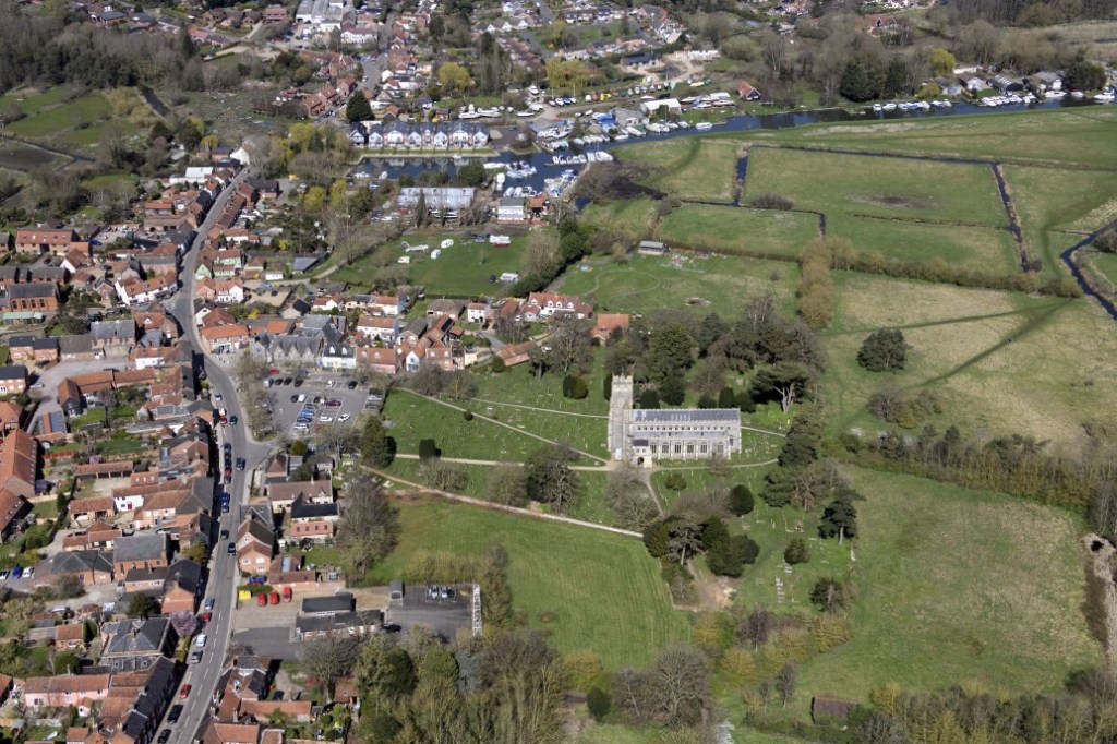
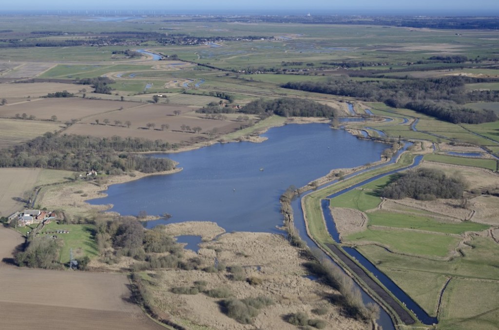
Looking at the photo, I was a bit disappointed not to find our small gaff – sadly we’re just out of the picture. So I did a bit of digging and uncovered a hoard of amazing aerial shots, mostly on Flickr from the talented lens of a fella called John Fielding. I found various images – of the Staithe, of Loddon’s grand 15th-century Holy Trinity Church, of Hardley Flood* and (my favourite) a long shot of the River Chet from the Staithe to the Flood. But still no Pansies HQ, though. Sad face 😞
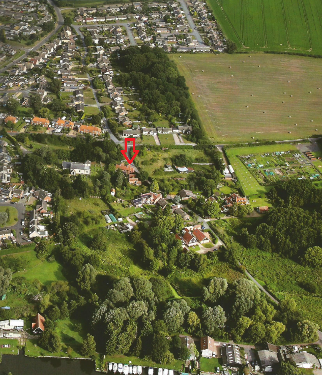
But then I remembered we had an old parish plan which features an image of Chedgrave on the front cover. And lo and behold, here we are, although you’d need a keen eye and a magnifying glass to spot us so I’ve added a red arrow. Now we’re in the picture. Happy face 😁
*Hardley Flood is an area of tidal lagoons and reedbeds providing a spillway for the River Chet and a nationally important bird sanctuary.
